![]() Key
Key
![]() Spain
Spain
![]() Galicia
Galicia
![]() Basque
Basque
![]() Catalonia
Catalonia
![]() Balearics
Balearics
![]() Andalucia
Andalucia
![]() Canaries
Canaries
![]() Osborne
bulls
Osborne
bulls
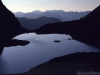
Ason
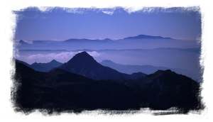
Picos
Pyrenees
Walking in Spain & its islands - Guide Books & Maps
 Spanish
people love to walk, but they don't generally go about it in the way the
British do. Where our inclination is to head out of town and find a public
footpath, they will head for the centre of town and 'paseo'. And they won't
be wearing baggy shorts and boots, they will wait until the day cools into
evening, put on their best clothes and parade past each other in the town
'Plaza Mayor' or down a 'Rambla' until it is time for dinner at about midnight
(in the cities). In a generally hot and dry country this isn't surprising,
sweating across the 'meseta' under a blazing sun is no fun (except for
mad dogs and Englishmen? The sensible learn to siesta). The best walking
therefore is away from the midsummer heat in the mountains and islands.
Spain has a strong and fascinating culture which can add a lot of enjoyment
to a trip. Combine a city break in Madrid
with the Gredos or Barcelona with the Pyrenees.
A beach holiday in Mallorca with walking
in its mountains or mix the high mountains of the Sierra Nevada with the
sleepy 'white towns' of Andalusia
Spanish
people love to walk, but they don't generally go about it in the way the
British do. Where our inclination is to head out of town and find a public
footpath, they will head for the centre of town and 'paseo'. And they won't
be wearing baggy shorts and boots, they will wait until the day cools into
evening, put on their best clothes and parade past each other in the town
'Plaza Mayor' or down a 'Rambla' until it is time for dinner at about midnight
(in the cities). In a generally hot and dry country this isn't surprising,
sweating across the 'meseta' under a blazing sun is no fun (except for
mad dogs and Englishmen? The sensible learn to siesta). The best walking
therefore is away from the midsummer heat in the mountains and islands.
Spain has a strong and fascinating culture which can add a lot of enjoyment
to a trip. Combine a city break in Madrid
with the Gredos or Barcelona with the Pyrenees.
A beach holiday in Mallorca with walking
in its mountains or mix the high mountains of the Sierra Nevada with the
sleepy 'white towns' of Andalusia
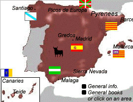
Spain is not a crowded country, forget your holiday brochure images of the 'costas'. Hire a car almost anywhere in Spain and you can be in country untouched by tourism in half an hour. Spanish people like each others company, so everybody crowds together in the town, so you won't find straggling suburbs carrying on for miles like London or Los Angeles (USA). There are mountain ranges and gorges to be found all over Spain but the Pyrenees, Picos and Sierra Nevada are the most significant. The central meseta (tableland) forms a high flat plain around Madrid with roads running in straight lines for miles. Only the south (Andalusia) has the characteristics usually associated with all of Spain (gazpacho, flamenco, gypsies and mañana1). Central Spain is the land of the serious Castilian with his castles and roast meat. Barcelona and the rest of Catalonia is almost a different country with its own language (as do the Basques and Galicians) and a similar relationship to Castile as Scotland does to England. The extensive north coast of the Basque country, Cantabria, Asturias and Galicia are much cooler than the rest of Spain, although the Spanish exaggerate the amount of rainfall there (from a British viewpoint).
1 mañana can mean tomorrow (adverb), tomorrow morning (feminine, mañana por la mañana) or the future (masculine).
I have used
the![]() symbol to indicate
a good walking destination in the area guide section rather than to indicate
the best book as choice of book tends to depend on the balance of walking/climbing
information required.
symbol to indicate
a good walking destination in the area guide section rather than to indicate
the best book as choice of book tends to depend on the balance of walking/climbing
information required.
Goto
Area Guide Books index
Some
possible destinations
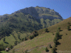
Cazorla
Camp
or stay at the parador among the wild pigs and pine martins.
Mallorca
combine
a beach holiday with the mountains of the north.
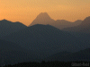
Pyrenees
enjoy
hut or tent based walking in the better weather of the Spanish side.![]()
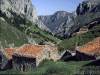
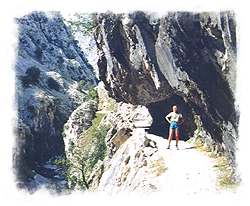
Picos
de Europa walk the lip of a gorge, stroll up to the real Las Vegas
or climb a serious mountain.
Sierra
Nevada mountains (often snow covered - with some piste skiing)
above the Andalusian coast and the Alhambra at Granada .The Sierra Nevada
is little used for walking and solitude is almost guaranteed away from
ski developments.
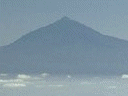
Tenerife-
Teide,
Spain's highest mountain and volcano at the centre of a holiday island
.
La
Palma Volcanic island in the Canaries.
Gran
Canaria Start
walks high in the mountains.
Maps
 Spanish
maps can often be obtained from specialist suppliers such as Stanfords
in Long Acre, London and Corn Street Bristol. (email Stanfordsmail order)
Spanish
maps can often be obtained from specialist suppliers such as Stanfords
in Long Acre, London and Corn Street Bristol. (email Stanfordsmail order)
Spanish
O.S. maps: Servicio Geografico Del Ejercito produce Cartografia Militarde
España - series L maps 1:50,000, C at 1:100,000 and 2C 1:200,000
The
I.G.N.(Istituto Geografico Nacional) produce folded sheets of areas of
interestat 1:50,000.
I
am afraid few of these maps are quite up to O.S. standard, perhaps we get
a little spoilt in Britain.
The
Canaries are covered by Freytag & Berndt maps at 1:35000-1:75000. These
maps show hiking trails in red which can be expected to exist on the ground
and be waymarked. They also show black dotted footpaths of a less certain
nature. Roads are graded to differentiate tarmac and jeep tracks. Although
in National Parks jeep tracks may have been closed to vehicle access and
are now used as footpaths.
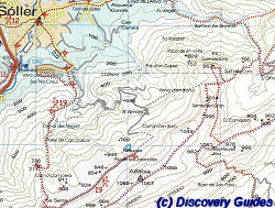
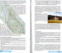
Discovery
Walking Guides and maps (small section reproduced
here- above right) are setting the standard for spanish maps.
Regional
guidebooks with general information and typically 34 route descriptions
+ short walks backed up by map excerpts at 1:25000 and 1:40000 and photos.
Tour
and Trail maps at 1:40000 complement the guides, showing routes and
printed on durable or indestructible material. Walkers maps are of 1:25000
scale, again to match with the guides but at a scale ideal for individual
walks.
Drive!
touring
maps with city street plans are ideal for the motorist. All the maps are
GPS1 ready and are far more accurate and up to date than
typical Spanish mapping.
GPS
navigator are available on a CD ROM![]()
1]
If
GPS is a mystery to you try GPS the easy way.![]() Best
selling introduction to GPS.
Best
selling introduction to GPS.
Discovery
UK guides
Jeep tracks and "Forestals"
If you hire a 4x4 and decide to follow jeep tracks to get to the start of walks or as an end in themselves, do bear in mind the possibility of breakdown, always carry clothing, food and water in the vehicle. As 4x4s kick up a lot of dust (especially in the dry Canary Islands) I stop or drive at walking pace when passing walkers or riders. Don't risk getting stuck by tackling routes that look excessively steep or rough. Do respect any signs restricting use of tracks to walkers. Many tracks are sufficiently exposed for a mistake to result in very serious consequences indeed. In any case the degree of insurance cover may be ambiguous when operating off tarmac, even in patently off road vehicles. Ordinary cars are not suitable for forest roads due to the lack of robust tyres and lack of ground clearance, although you will often see the locals using them to get to barbecue (merendero)sites.
Also - Walking in Andalucia Santana
Excellent general guide to Spain for everything other than walking/climbing. Food, restaurants, accommodation, culture, history, architecture etc.
 Excellent
pocket sized general guide with heavy emphasis on visual presentation by
maps, 3D street plans, cutaway diagrams, drawings and photos. Remarkably
easy to follow compared with a written guide. Also these guides hit those
little things that can be so useful. For instance - photos of the different
kinds of police uniform and their cars (with descriptions of their duties),
what letter boxes look like and photos of bus stops not to mention typical
brandy bottles!
Excellent
pocket sized general guide with heavy emphasis on visual presentation by
maps, 3D street plans, cutaway diagrams, drawings and photos. Remarkably
easy to follow compared with a written guide. Also these guides hit those
little things that can be so useful. For instance - photos of the different
kinds of police uniform and their cars (with descriptions of their duties),
what letter boxes look like and photos of bus stops not to mention typical
brandy bottles!
History and culture. "What to see" with cutaways and floorplans so you will not need further guides. Street maps. Restaurant and hotel listings. Entertainment. Survival guide. Travel information.
"The guides that show you what others only tell you".
More
detailed local versions (recommended) :-
Seville
and Andalucia
![]()
![]()
Barcelona
and Catalonia
![]()
![]()
Madrid
![]()
![]()
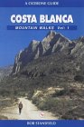 Costa
Blanca mountain walks Stansfield Cicerone
Costa
Blanca mountain walks Stansfield Cicerone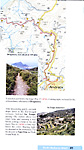 Walk!
Mallorca West (right)
Walk!
Mallorca West (right)
 Torre
deCerredo 2648m. El Naranjo 2519m. PeñaVieja 2613m. Torre de Llambrion
2642m.
Torre
deCerredo 2648m. El Naranjo 2519m. PeñaVieja 2613m. Torre de Llambrion
2642m.
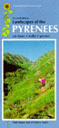
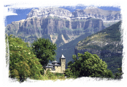 The
Spanish side of the mountains has better weather than the French side,
car hire costs less and the people are more friendly. Ordesa
The
Spanish side of the mountains has better weather than the French side,
car hire costs less and the people are more friendly. Ordesa 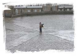
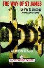 Guides
and maps now becoming more easily available to the pilgrim route and the
EU plans to link the Camino through to Winchester! A long distance path
indeed. The route in Spain starts near San Sebastian (pilgrims may start
from anywhere, St.Jean in the Pyrenees is a good choice, but some will
start at Arles or even Paris), passing through Pamplona (famous for its
running of the bulls), Burgos and Leon on its way to Santiago (about 800
Km). (Guard against old maps as Galicia has built many new roads in recent
years.). The route is way marked with yellow paint, scallop shells, pilgrim
figures and EU signs. About 16,000 people do the route each year and May
is probably the best month to start.
Guides
and maps now becoming more easily available to the pilgrim route and the
EU plans to link the Camino through to Winchester! A long distance path
indeed. The route in Spain starts near San Sebastian (pilgrims may start
from anywhere, St.Jean in the Pyrenees is a good choice, but some will
start at Arles or even Paris), passing through Pamplona (famous for its
running of the bulls), Burgos and Leon on its way to Santiago (about 800
Km). (Guard against old maps as Galicia has built many new roads in recent
years.). The route is way marked with yellow paint, scallop shells, pilgrim
figures and EU signs. About 16,000 people do the route each year and May
is probably the best month to start.
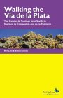 Walking
the Via de la Plata - Cole, Davis
Walking
the Via de la Plata - Cole, Davis
 The
scallop shell is the symbol of Santiago and of the pilgrimage and some
pilgrims will wear a scallop shell round their necks. Indeed, when you
finally arrive in Santiago you will find excellent scallops and other seafood
available at reasonable prices for a celebration meal.
The
scallop shell is the symbol of Santiago and of the pilgrimage and some
pilgrims will wear a scallop shell round their necks. Indeed, when you
finally arrive in Santiago you will find excellent scallops and other seafood
available at reasonable prices for a celebration meal.